|
http://www.capitalpress.info:80/main.asp?Search=1&ArticleID=40430&SectionID=67&SubSectionID=1253&S=1
Maps
put basin's water, fertilizer in perspective
Geologic
study changes thought on sources of irrigation, water quality
Capital Press by Lee Juillerat,
3/28/08
KLAMATH FALLS,
Ore. - Recent geological studies in Southern Oregon's
Klamath Basin may change some long-held assumptions about
where to drill for water wells and the impacts of fertilizer
and manure on Upper Klamath Lake's water quality.
The Oregon Department of Geology and Mineral Industries
recently released two geologic maps of Klamath Falls and
Klamath County's Upper Klamath Basin. Information-gathering
for the maps began in 1998.
"It's very interesting to have an understanding of the
geologic history, and it's different than what we thought,"
said Ian Nadin, the department's chief scientist.
Among key points:
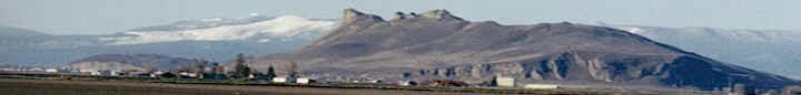
n Most of the volcanic activity that has shaped the Upper
Klamath Basin has occurred within the past 1 million to 2
million years. "If we go back 3 million years, (the terrain)
was pretty much as flat as a pancake," Nadin said.
n The upper basin has 464 volcanoes, which range from
massive mountains like Shasta and McLoughlin to small cinder
cones.
n By identifying fault lines, which typically are sources of
underground water, the probability of locating and drilling
less expensive, high-volume water producing wells is
improved.
n Many ridges and mountains previously thought to be lava
flows that contain underground aquifers are actually thin
layers of lava atop chalk rock and are not good prospects
for drilling successful wells.
n Higher-than-normal naturally occurring levels of
phosphorus are responsible for reducing water quality in
Upper Klamath and other lakes. Ranchers and farmers who use
fertilizers, as well as cattle manure, have historically
been blamed for the unusually high phosphorus levels.
Nadin said the findings involving phosphorus are important
because steps to reduce fertilizer or cattle grazing use
could harm crop production and ranching while having little
or no impact on improving water quality. Although the amount
of naturally occurring phosphorus is small, 1 percent, he
said the amount is 10 times higher than in other areas.
Phosphorous is found in rocks, sediment and water from
springs.
"Some of that impact of phosphorous is natural. If a large
percentage is natural and farmers are not allowed to use
phosphorous fertilizer, it could have no impact on the water
quality but could be detrimental to farmers," Nadin said.
"Changing when and how you till may have more impact than
how and when you fertilize."
|
Phosphorous
levels
Richard Roseburg, an associate professor at the Oregon State
University Research and Extension Center in Klamath Falls,
said he isn't surprised that new findings show phosphorous
is naturally occurring in Upper Klamath Lake.
Roseburg said phosphorous is a major element that
contributes to algae blooms in the lake and the Klamath
River. When the blooms die, the decomposition process uses
oxygen in water, which can result in fish die-offs.
He said studies have shown lake sediments are high in
phosphorous and that other quantities come from springs in
and outside the lake.
While phosphorus is used in some fertilizers for such row
crops as potatoes, wheat and onions, he said "not very much
of that tends to move out of the soil." Phosphorus is also
found in cattle manure, but Roseburg said the amounts are
generally not significant unless high quantities are
deposited in moving streams.
Maps available
Copies of two geologic maps of Klamath Falls and the Upper
Klamath Basin are available from the Oregon Department of
Geology and Mineral Industries.
Geologic map GMS-118 was started primarily in response to
the 1993 earthquakes that caused widespread damage to the
Klamath County Courthouse, 16 other downtown Klamath Falls
buildings and the neighboring region.
Open-File Report O-07-05 is a mapping project that began in
support of GMS-118 and was expanded because of the basin's
increased focus on water issues.
"This compilation of 47 different geologic maps provides
critical information for understanding the groundwater
resources and the connections between groundwater and
surface water in the upper Klamath Basin," said Ian Madin,
the department's chief scientist. "It also identifies
hundreds of newly mapped volcanoes in the area that have
erupted over the past few million years into an environment
of giant lakes."
The two maps are available on CD-ROM for $10 each. Printed
copies are $15 each. They are available from the Nature of
the Northwest Information Center, 800 NE Oregon St., Suite
177, Portland, OR 97232; by calling (503) 872-2750; or
online at www.naturenw.org.
|
|