Our Klamath Basin Water Crisis
Upholding rural Americans' rights to grow food,
own property, and caretake our wildlife and natural resources.
Our Klamath Basin
Water Crisis
Upholding rural Americans' rights to grow food,
own property, and caretake our wildlife and natural resources.
|
The Pioneer Press,
at the very top of the State of California,
grants permission for this article to be copied and
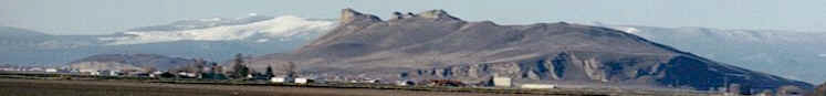
forwarded. Pioneer Press, Fort Jones, California Wednesday, February 2, 2005 The flood of 1964 recalled -- Callahan, California was one of many towns blasted by rushing waters. By Liz Bowen, assistant editor, Pioneer Press, Fort Jones, California Part I -- CALLAHAN, CALIFORNIA – Gushing waters roared. Boulders crashed and cracked as the South Fork of the Scott River rampaged over its banks. For days the rain poured down – on snow – way up to the mountaintops. The earth vibrated and rumbled from the pounding. When would it stop? Forty years ago the 1964 flood hit just before Christmas in this old mining town and farming area at the top of the State of California. It had been cold and snowed before the warm tropical rain storm descended. Then the world weather patterns turned and arctic cold again brought several feet of the white stuff, which covered the devastation. (The population of Callahan averaged around 100 in 1964. Present-day Callahan boasts 50 residents.) A month later in February 1965, folks were still assessing and addressing damage. It was the timber industry that provided much of the muscle for repairing bridges and roads and flooded lands. Trucks hauled bulldozers and helicopters flew rescues and food to stranded families. Neighbors helped neighbors look for belongings, clear rubble or build a new home. The scene from Callahan was repeated in communities and cities throughout the Pacific Northwest that winter. Nature released its furry with what is now called a Pineapple Express. At the crossroads of 2004 into 2005, a Pineapple Express pounded the southern portion of California with floods and mudslides destroying homes, businesses and lives. But in 1964, the entire Pacific Coastline of California, Oregon and Washington were smacked by tropical storms. The high water marks from the racing huge waters can still be seen in gulches and gorges like the Rogue River in Oregon, which is 100 miles to the north of the South Fork of the Scott River. Many cities along the Oregon and California coasts were flooded and towns were wiped out. The deluge took out bridges, homes, highways and farms. Humboldt County was stunned, when it discovered that it was completely cut off from the rest of the world. The Eel River was expected to top-out at 25 feet, but it crested at 29 feet. A helicopter attempting to evacuate Ferndale residents crashed on Dec. 22, killing all seven on board added to the misery. Thousands of cows and other farm animals and wildlife were drowned. No it wasn’t a tsunami, like the huge waves that killed 178,000 people in Southeast Asia on December 26, 2004. It is just what is referred to as a 100 or now sometimes, a 1,000 year flood. The previous flood in December of 1955 was the highest on record. Floods and highwaters are not unusual, but it is difficult to be prepared for the really big ones. A highwater was again felt in early January 1974 as it rained on snow and gulches funneled waters down, down to the valleys. One hundred miles to the south of Callahan and Scott Valley, Shasta Lake filled up faster than water could be released from the dam and flowed over the top flooding homes along the Sacramento River. Again Scott River overflowed its bounds making a huge lake in the valley floor. Then nine years later the winter of 1983, brought one of the heaviest snowpacks in the last 60 years of recorded history. It was the warm early summer temperatures on Memorial Day that brought light flooding from the Scott and its snow-fed tributary streams. Next week: The recollections from Callahan residents
|
Home
Page Updated: Thursday May 07, 2009 09:14 AM Pacific
Copyright © klamathbasincrisis.org, 2005, All Rights Reserved