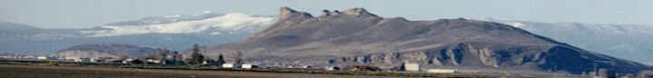
The Scott River Water Trust is a solution in
search of funding.
followed by
Scott River Water Balance5/2007 by
Marcia Armstrong, Siskiyou County Supervisor
The problem is: during late summer and early fall, low water
levels in some streams limit the amount of rearing and spawning
habitat available for anadromous fish, (coho and Chinook salmon
and steelhead trout.) An answer is: to raise water levels to
accomplish specific flow targets that will increase habitat when
needed for critical stages of fish life. The approach is: to
solicit voluntary temporary dedication of water to the stream in
exchange for a fair compensation at least equal to the value of
the water had it been applied to the land.
We now understand much better how fish use the Scott River
watershed during their different life stages. For instance, we
know that the fish need
25-30 c.f.s. (cubic feet per second) of fall flows at the USGS
gage to travel up the canyon to spawning areas in the valley. We
know that a total flow of around 17 c.f.s. is needed at French
Creek and at Shackleford Creek for connectivity with the mainstem
Scott River. In most cases, it takes anywhere from and additional
.5-2 c.f.s. in specific reaches from July to the end of the
irrigation season in October, (or when the rains come,) to meet
targeted flows for rearing and spawning.
Scott River water use rights are governed by a formal adjudication
(Siskiyou County Superior Court) establishing volumes and
priorities of surface water and associated groundwater use in
various reaches throughout the system. A legal analysis has been
completed for the Trust concept working with the adjudication to
create a decision tree which asks such questions as: Does the
stream provide habitat? Are there sufficient natural flows to meet
targets? Are there willing participants? Can they demonstrate the
recent use of water? Are there concerns that non-participants can
use any water dedicated under their adjudicated right? These
questions will help determine the best candidates for the program.
Although some of the adjudicated rights are riparian and cannot be
lost from non-use, many are early appropriative rights that date
back as far as the gold rush era. Such rights can be lost from
nonuse - claimed by another diverter after five years (statute of
limitations.) Since it has been almost impossible to get a
permanent dedication of water through the legal process, the Water
Trust proposes to use "forbearance contracts" that run from one to
three years. Most will take the form of a split season lease,
allowing the participant to soak with flood irrigation in the
plentiful months from April through June, with cessation of all
irrigation as of July or after the second pasture cutting.
(Alfalfa and pasture are perennial crops with seven and twenty
year productivity spans respectively. This may have some long term
impacts on the productivity of the crop.) Stockwater diversions
run all year round. Ranchers could find alternative sources of
water during critical periods under forbearance agreements.
An economic study is being completed by WestWater Research on the
economic valuation of agriculture water in Scott Valley for crops
and livestock. The study will also examine appropriate funding
sources from a special district to grants or an endowment fund
that will provide sustainable funding for the Trust. For instance,
it is estimate that a $2 million endowment would yield
approximately $80-100,000 in interest. This might secure an
additional 7-9 c.f.s. in the tributaries from forebearance
agreements on irrigation of marginal pasture and stockwater
diversions. (The cost of forbearance on alfalfa crops would be
considerably more as a higher valued crop.) Single year contracts
would vary according to the type of water year and consequential
value of that year's water to the fish. Multiple year forbearance
agreements would most likely be based on an average water year.
The sooner a source of funding steps forward, the sooner this fair
win/win solution can be implemented.
-------------------------------------------------------------------------------
Recently, the Scott River Watershed Council
(SRWC) gave an update on its progress in developing a
water balance for the Scott River system. A water balance takes
into account inputs from precipitation - rain and snow. It
examines how that materializes into surface water flows,
groundwater storage and snowpack storage to be delivered later
though snowmelt. It also looks at outputs - diversions of surface
water and pumping of groundwater and how that affects
hydrology/the water system. It creates a model over space and time
to help us understand how the entire system functions.
The water balance will be helpful in improving water management
practices, implementing the water leasing or Water Trust concept,
developing a dry year water plan and in identifying stream reaches
with the highest potential for habitat restoration.
In 1998, the Siskiyou Resource Conservation District (RCD) began
to compile all available water data for the system. This included
flow readings from 1941 to present at the USGS gauge below Fort
Jones. In 2002, the California Department of Water Resources and
the U.S. Fish and Wildlife Service installed additional river flow
gauges at: East Fork Scott, South Fork Scott, McConaughy, Sugar
Creek, Shackleford , Mill, Kidder, French and Etna Creeks. In
addition to two existing U.S. Forest Service gauges, in
2003 the RCD installed 10 rain gauges.
From 2003-2005, a rough spreadsheet model of the hydrology of the
system or water balance was developed by Mike Deas Ph.D, which
continues to be refined as more detail is known.
In 2005, a draft run-off forecast model was created. This model
has taken into account all snowpack and rainfall data for the past
50 years.
(See DWR Bulletin 120.) The run-off forecast considers
precipitation and groundwater conditions of the previous year,
variations in precipitation over time and space throughout the
system, and changes in land and water use patterns. The model
predicts the volume of water that will flow through the Fort Jones
gauge from April 1-October 1 based on April 1 snowpack and
precipitation conditions. Refinements are underway to forecast at
the subwatershed level.
A water year type index has also been created categorizing years
as wet, dry or normal and looking at the combined effects of a two
year span. Keeping in mind that the forecast is limited to
conditions as they were prior to April 1 of the current year, this
information can be used to describe the water supply conditions
anticipated in a given year.
DWR has periodically taken measurements from 3 wells over a 50
year period. In 2006 an additional voluntary groundwater study
piece was added. This study selected 33 wells located in a grid
over the central portion of Scott Valley to measure the static
water level of each well throughout the year. It was determined
from the first year's measurements that all wells do not react
similarly. During the year, wells in the main part of the valley
near the river followed the river's hydrograph - dropping 3-4 feet
during the summer. They began to inch up in October after the
first frost, but did not really begin to recover until December. A
few wells in other areas did not see the same recharge. It is
anticipated that at least 10 years or more of readings will need
to be taken to capture most of the water year and runoff
variations so that we have a better idea of how groundwater
responds to various water conditions.
|