http://www.heraldandnews.com/articles/2005/05/06/news/top_stories/top1.txt
Drought? Lake's nearly full and rising
May 6, 2005
By TODD KEPPLE
 |
|
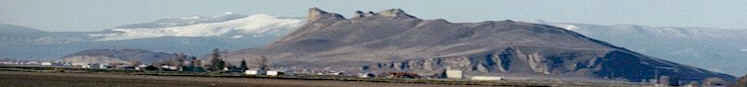
Upper Klamath Lake was brimful Thursday,
prompting PacifiCorp to issue an advisory
about the possibility of localized
flooding along the lakeshore. The federal
government has ordered water to be
released from the lake in case more rains
come. |
|
The Klamath Basin may be
in the grips of drought, but the timing of the
recent rainy spell means the Bureau of Reclamation
will have to spill water from Upper Klamath Lake
in case the wet trend continues.
Bureau officials worked to conserve water for
months during the recent mild winter, and had
managed to nearly fill Upper Klamath Lake when the
weather turned decidedly wet last week.
Now there's no room to
store the extra water coming in, said Cecil
Lesley, chief of water operations for the Klamath
Reclamation Project.
Flows at Link River Dam were increased this week
to 3,500 cubic feet per second, or more than five
times the amount of water that was being released
last week.
PacifiCorp, which operates the Link River Dam
under a contract with the Bureau of Reclamation,
issued an advisory Thursday that localized
flooding around Upper Klamath Lake is possible if
heavy rains occur during the next few weeks while
the lake is brimful.
People who have property alongside the lake may
want to take precautionary measures, the company
said, particularly since the weather forecast
calls for more rain over the coming weekend.
"PacifiCorp has been in consultation with the U.S.
Bureau of Reclamation about lake levels and
expected inflows," the company said in a statement
Thursday. "The (Bureau of Reclamation) has taken
this information into consideration and directed
(us) to increase flows at Link River Dam."
Releasing more water from Link River Dam will
create space in Upper Klamath Lake to hold heavy
inflow that might result from rainstorms.
Upper Klamath Lake is
considered to be full when the water level reaches
4,143.3 feet above sea level. By early this week,
the lake was within an inch of its maximum level.
In some places, that
leaves only a few inches of dike to keep water
from spilling onto low-lying property beside the
lake.
Officials are concerned about the possibility of
strong winds affecting the lake level. A strong,
sustained wind can push water from one side of the
lake toward the other, cause the surface elevation
to vary by several inches.
The prospect of the lake overtopping its banks
comes less than two months after Gov. Ted
Kulongoski declared a drought emergency in Klamath
County.
Kulongoski's drought
declaration came in mid-March, when the Klamath
Basin was suffering a stubborn drought that left a
mountain snowpack measuring about half of average.
The Bureau of Reclamation, hoping to conserve as
much water as possible for the benefit of
irrigators and fish, took measures during the
winter and early spring to curtail flows in the
Klamath River and hold water back in Upper Klamath
Lake.
By late April, it appeared
the lake would come close to filling. That's when
the rains started coming, swelling streams and
rivers feeding into Upper Klamath Lake.
The Williamson River, for instance, was flowing at
1,310 cubic feet per second Thursday at a stream
gauging station near Chiloquin. That's still below
average for this time of year, but much higher
than the 865 cfs flowing in the river only two
weeks ago.
As a result, the remaining
space in the lake filled quickly, and left no room
to spare for any sudden inflows that might result
from new storms.
Releasing more water from Upper Klamath Lake will
boost flows in the Klamath River, where fishery
interests have been concerned about low flows
affecting runs of salmon, including the threatened
coho.
The rains come as welcome
relief for irrigators, Lesley said. But while the
rains have been enough to top off the lake, they
haven't been enough to wipe out the effects of
several dry months over the winter.
"The wet weather has slowed down the use of
irrigation water, and we don't expect extensive
irrigation in the Project for probably another two
weeks, which is well into our regular irrigation
season," Lesley said.
"However, we just received the first of May (streamflow)
forecast, and it still calls for dry conditions,
as far as inflow to the lake is concerned."
Lesley said the rains have also brought very
little relief to the Project's east side, where
irrigators rely on Clear Lake and Gerber
Reservoir.
"Both of them have received minor amounts of
water," Lesley said. "Clear Lake is still
extremely dry, and we've seen some increases in
Gerber, but it still won't be a full supply."
Falls revealed: Here's how to see them
The falls for which Klamath Falls is named largely
disappeared 85 years ago when the
California-Oregon Power Co. built a dam on Link
River, the outlet of Upper Klamath Lake.
Remnants of the falls can still be seen, however,
particularly in relatively wet years when Upper
Klamath Lake fills and extra water is released
from the dam, as is the case this week.
To see the falls, take the Link River Trail from
its southern trailhead, near the Favell Museum.
Hike slightly more than a half-mile up the trail,
to the point where the north half of the trail is
closed due to construction work.
Several unmarked paths lead down to the river's
edge. Thick brush and blackberry brambles can make
the going difficult. The north half of the trail
is closed to keep the public away from the
construction zone where a new fish ladder was
recently installed.
- By Todd Kepple