|
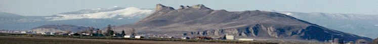
Despite snow showers, lake
level is low

Upper Klamath Lake has been rising only
slightly despite heavy snow. Now lake
managers are worried about warming a
trend. |
Published Jan. 9,
2004
By DYLAN DARLING
The snow that
rings Upper Klamath Lake hasn't changed the
way the U.S. Bureau of Reclamation sees the
lake - it's low.
"I'm still
assuming we are in a drought condition," said
Dave Sabo, manager of the Klamath Reclamation
Project. "Until I see the lake full, I am
assuming we are dry."
As of Tuesday the
lake was at 4,139.7 feet above sea level. Full
pool is at 4,143.3.
That 51/2 feet of
difference in elevation amounts to more than
250,000 acre-feet of water, or enough to cover
every acre of land in the Klamath Reclamation
Project with a foot of water.
Cecil Lesley,
project water and land chief, said the lake
has been rising a couple of hundredths of a
foot per day since the Bureau made a deal with
the U.S. National Marine Fisheries Service to
lower flow requirements on the Klamath River.
The fisheries service wrote the biological
opinion for the Klamath River, which guides
how the Bureau should control flows to help
coho salmon.
The move lowered
the required December flows from Iron Gate
Dam, located on the Klamath River just south
of the Oregon-California border, from 1,621
cubic feet per second to 1,300 cfs. As of
Tuesday, inflows in the lake were steady at
about 1,400 cfs, but could spike with a
thawing of the recent snowfall, Lesley said.
Now the Bureau is
left in a bit of a bind.
The agency wants
some of the snow at lower elevations and in
the hills to melt, come down and fill the
lake. But not too fast.
Lesley said a
strong snowpack is crucial for a solid
irrigation season.
"We've got a lot
of area to store water, but we don't want to
lose the majority of snow," Lesley said. "We
think of the snowpack as our upper-level
reservoir."
The "reservoir"
of water in the form of snow up in the
mountains comes down with the warming of
spring and keeps coming through summer.
But, even heavy,
heavy flows now might not mean robust streams
and rivers into Upper Klamath Lake in the
spring.
Lesley said there
have been three dry years in a row, so the
aquifers that feed the springs, which in turn
feed the surface flows, might have a low
charge.
To get the
aquifers charged up, the Bureau is hoping for
a slow snowmelt. Lesley said a quick melt
would mean a flash of water down the rivers
and streams, through the lake and out to sea.
For the short
term, things have warmed up - Friday morning's
low was 36 degrees at 4 a.m., according to the
National Weather Service.
Earlier in the
week, weather forecasters predicted that a
"Pineapple Express," or moisture-laden
tropical system blown in from Hawaii, would
warm up and wet down most of Oregon, including
the Klamath Basin.
So, Lesley said,
some steps were taken downstream to prepare
for a possible increase of water.
The Bureau, at
the request of PacifiCorp, increased flows
from Iron Gate and Copco reservoirs over last
weekend to reduce the potential for flooding
if an expected warming brings a rush of water
from the hills.
Lesley said the
flows from Iron Gate Dam topped out at 1,735
cfs on Saturday, and flows Tuesday were back
to 1,300 cfs. While flows increased
downstream, he said flows from the Link River
Dam, which holds back Upper Klamath Lake, were
decreased.
During last
weekend the Bureau cut flows from the Link
River Dam down to 490 cubic feet per second.
On Thursday, Lesley said the flows were close
to their 900 cfs average for this time of
year.
The combined
effect was the drop in level of Copco and Iron
Gate Reservoirs, but those are minor pools
compared to Upper Klamath Lake, he said.
But now it looks
as if the Pineapple Express isn't going to
happen.
George Taylor,
Oregon's state climatologist, said a Pineapple
Express is marked by heavy tropical moisture
and a big jump in temperatures. He said the
system now hitting the coast is a normal storm
system with some tropical moisture. Last night
the first stretches of the system came across
the Basin, bringing a splash of rain and a
small boost in temperatures.
While the change
in weather could melt some of the snow piled
up at lower elevations, the snow up in the
mountains should remain.
"I think you will
be able to hold on to that hard-earned snow a
little bit longer," Taylor said. |