Our Klamath Basin Water Crisis
Upholding rural Americans' rights to grow food,
own property, and caretake our wildlife and natural resources.
Our Klamath Basin
Water Crisis
Upholding rural Americans' rights to grow food,
own property, and caretake our wildlife and natural resources.
|
Gail Hildreth Whitsett 23131 N. Poe Valley Road Klamath Falls, Oregon 97603 Mr. Michael Grainey, Administrator OOE Ms Shelly Cimon, Chair OEFSC 625 Marion Street NE, Suite 1 Salem, Oregon 97301-3742 January 24, 2004
Dear Mr. Grainey and Ms. Cimon,
Please admit the following comments to be heard/read by the Oregon Energy Facility Siting Council in their final determination of whether to allow a building site permit for People’s Energy Corporation for construction of the California Oregon Border 1160 MW gas fired electrical generating plant in the EFU designated rural area of Langell Valley, Oregon . These are opinions formulated from data in the COB draft proposal (I am not a registered geologist in Oregon). I ask that these written comments replace the public comments I made on January 22, 2004 on the Draft Proposed Order because these comments are more detailed and present additional facts not previously noted. The Draft Proposed Order for the COB Energy Facility contains numerous apparent errors of fact. I will refer to the statements in question in order and by page number and line. Page 10, lines 33-34: COB is not entitled to a new state-administered water use certificate issued before any of the other 32 more senior water use permit applicants in the same water use area receive water right certificates. These senior priority applicants are presently being denied full permanent certification and permits by the OWRD. COB should only be allowed a new water permit AFTER the other 32 individuals with senior valid claims are granted their full permanent permits. The OOE and ODWR are in apparent violation of the law if they allow the COB plant final permit to move ahead of the other more senior applicants. Page 10, lines 39-40: An isolated deeper zone aquifer does not exist; state and federal hydrologists have proven that a degree of connectivity exists between the two water bearing units. COB is attempting to say that the water bearing zones constitute an isolated "aquifer" but in fact an isolated aquifer must have certain delineations including geometric and geographic definition, re-charge area definition and discharge area. COB has not identified an isolated separate deeper aquifer by the above normal methods employed by hydrologists. Additional mandatory tests that should be done, include utilization of isotope studies of the water from the Babson Well deeper water bearing unit and comparing them to the results of the isotopes found in the stratigraphically higher water-bearing unit of the same well. It is believed that no hydrologic study of the Babson well can be considered finalized or complete without an isotope study of the water bearing units. Further references to this "isolated deep aquifer" exist throughout the Draft Proposed Order and its Attachments as well as through out the EIS. This is a very important concept to understand because the "isolated deep aquifer" stance is being falsely promulgated by COB to achieve compliance with other Oregon statutes, and goals mentioned in the Draft Order. In fact, the OWRD and the USGS directly deny that the deeper water bearing zone found in the Babson Well is isolated. Marshall Gannett of the USGS stated in a letter to the USF&WS that "As you requested, I took a look at the report by CH2M Hill entitled Water Supply Supplemental Data Report- Deep Aquifer Testing at the COB Energy Facility Water Supply Well. You asked specifically if I could provide an opinion on the adequacy of the report to say there would be no measurable or significant effect on surface water. In my opinion, the report is not adequate to make that conclusion." Page 1, paragraph 1. And further on page 2 of the same letter, paragraph 1 " This strongly indicates there is some degree of hydraulic connection between the deep zone and the developed shallow zone from which irrigation pumping occurs." Also P. 2 last paragraph: "To summarize, the test and data presented in the report do not, in my opinion, support the idea that the deep water-bearing zone is hydraulically isolated from the shallow zone which is generally accepted to be in hydraulic connection with springs feeding the Lost River."
OWRD further states in the March 31, 2003 Review of Water Supply Supplemental Data Report: Deep Aquifer testing at the COB Energy Facility Water Supply Well by CH2M Hill for Peoples Energy Resources, November 2002 OWRD Technical Review: Page 2, Item 1.)"A response in the shallow ground water system connected to Bonanza Big Springs was unexpected and makes doubtful the complete isolation of deep ground water from shallow ground water in the area." Page 2, Item 6.) "The (1994, CH 2 M Hill) report notes deep ground water level trends before and after the interference test. It states the "…water level trends likely reflect seasonal recharge and pumping/ irrigation patterns. This statement in the report runs counter to the conclusion that the deep ground water is isolated from the shallow ground water. No seasonal pumping/ irrigation or recharge influence should be seen if the deep ground water is truly isolated." Page 3, Item 7: "These higher static water levels occur at a time when shallow ground water pumping for irrigation is decreasing and ceasing. This recovery (higher static water levels) in both shallow and deep ground water suggest the shallow and deep ground water are hydraulically connected." In the draft document (not yet finalized) Ground Water in the Eastern Lost River Sub-Basin, Langell, Yonna, Swan Lake and Poe Ground Valleys of Southeastern Klamath County, Oregon by the Oregon Water Resources Department, there are implied suggestions that are in direct contradiction to the COB statements referring to an isolated deep basalt aquifer. It suggests that under current Lost River management conditions, the calculated total basalt ground water drawdown by pro-rated pumping the Bonanza sub-area 5-year permit wells alone is sufficient to terminate Bonanza Big Springs flow in most years. This situation becomes even more problematic given that the exercise of the 5-year permits will occur in addition to the regular exercise of more senior ground water rights. From 1997 through 2002, the basalt ground water level at Bonanza Big Springs nearly met the river stage I in the summer of 1997, and 2000 and dropped below the river stage in the summer of 2001 and 2002. The Babson Well permit being sought by COB is the most junior right presently applied for in the Bonanza sub-basin. It would seem wise to wait to issue the COB site certificate until this OWRD document is finalized, which is supposed to be very soon. Two other wells with senior established permanent permits already exist on COB controlled land, located within the immediate vicinity the proposed plant site, the Jan Wright well and the Liston well. Both of these senior water right wells could provide the water necessary to run the COB plant (300 gpm), without the drilling of two additional wells or without the use of the Babson well, and without the 2.5 miles of pipeline needed to get the Babson water to the plant site. It is not true that the Babson well is unique and a necessity to provide water for the COB plant. See statements: Draft PO Attachment B, page 291 paragraph 3 " Nevertheless, the Energy Facility will still require some process water, and the applicant has provided evidence that the Babson well is the only source of such water that is available without adversely affecting existing water uses. The existence of the Babson well is one of the major reasons justifying the location of the proposed Energy Facility." "With a preexisting water supply, and the need to connect that supply to the proposed Energy Facility, it necessarily follows that the water supply pipeline connecting the existing well to the proposed Energy Facility is locationally dependent." The Jan Wright well flows enough water (1200 gpm) alone to provide the necessary water and it is already constructed, located on site, and has a senior permit. The Babson well, which is located 2 ½ miles away, and the two additional wells proposed to be drilled next to it, do not provide a unique or necessary condition. It is my opinion that COB repeatedly makes the many times, proven false "isolated deep aquifer" statement throughout the Draft PO and throughout the EIS in order to keep the facts from being known and understood regarding the influence of their pumping of the Babson well on the Lost River. With the OWRD and USGS written statements establishing the hydraulic connectivity of the deeper water-bearing basalt unit to the overlying water-bearing units, COB’s statements are proved false and without scientific basis. Isolated means "having
The connectivity of the Babson well and all wells in the Bonanza sub-area to the shallow ground water and consequently to the Lost River underscores the importance of not withdrawing any more water than is already being withdrawn. COB refuses to acknowledge the existence of the hydraulic connection of its wells to the groundwater system, and ultimately to the Lost River, by repeatedly making statements about the "isolation" of the deep aquifer in its Babson well. The reality is that if the COB plant is allowed to be built and use additional water over what is already being withdrawn in the sub-basin, along with drilling the two additional wells requested, it has the potential to interfere with the Lost River. COB persists in the Draft Order and EIS in repeatedly ignoring the many statements of the USGS and OWRD relating the hydraulic connectivity of the deep zone to the shallow zone. COB relentlessly infers that the Babson well is "unique" and postulates its entire reason for placing the facility at this site on the "isolated aquifer" and lack of interference with the Lost River and the overlying water bearing zones. Just because COB repeats this mantra ad infinitum, does not make it true. Nearly every section of the Draft PO and the EIS are predicated on the "isolated deep aquifer" statement. Numerous violations of the requested Goal 3 exemption are evident. I ask you to review those Draft PO statements which can no longer be considered true when one accepts the scientifically documented fact of hydraulic connectivity throughout the facility site wells and the ground water system that supplies the Lost River.
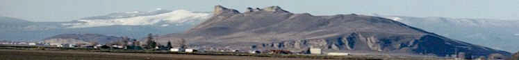
Recently, two of the highest ranking politicians within the state government of Oregon made comments and pledges to Klamath County regarding the use of agricultural (EFU) lands and agricultural water. Oregon Department of Agriculture Director Katy Coba was quoted in a lengthy January 12, 2004 Klamath Falls Herald and News interview as stating the following " I think another issue we have to be fairly vigilant about is land use" she said. "The issue of protecting agricultural lands is critically important to our producers and is something we must pay close attention to." Coba also believes water availability remains important. "The Klamath Basin situation has raised the issue to a national level the past couple of years. It’s ODA’s role to continue to advocate on behalf of agriculture for the use of water. There’s no question, the (agriculture) industry needs access to water throughout the state…..Anything we can do to provide additional quantities of water will be important." On December 10, 2002, newly elected Governor Kulongoski convened a meeting with Klamath County officials and politicians, as well as the Hatfield Upper Basin Working Committee, of which I am a member. Members of the federally funded Hatfield Committee ( founded by Senator Mark O. Hatfield in 1994, to address water issues in the Upper Klamath Basin), have been confirmed by Oregon’s governors and the US Secretary of the Interior. I received my confirmation as a member of the Hatfield Committee by Governor Kulongoski in the spring of 2003. I will QUOTE from the official minutes of the meeting, "Mr. Kulongoski reported he had just come from a meeting with the Water Users. He indicated that he and his administration are concerned and that this (the water rights issue) is a major issue for them. He will continue to be involved through the Department of Water Resources. He is very familiar with the water rights issues and would like to hear from the group what he can do to help. He added that he has found the Klamath issue to be one of the most complex he has seen- and he has a lot of experience with complex issues as (a) Supreme Court justice. He recognizes that the basin is dealing with limited resources with excessive demands. He added that the basin economy is vital to the State’s economy. He believes that the state is dependent upon the health of agriculture in the state. He is a supporter of land use and noted that the purpose of the land use laws is to keep agriculture functional. If agriculture fails economically, the public can no longer be expected to support land use laws." It seems apparent that Governor Kulongoski feels quite strongly about keeping EFU agricultural land use designated lands in agriculture, according to his own words. He also stated at that same meeting that he was instrumental in making the present EFU and Forest land use laws in Oregon and he fully expected them to be upheld. the Energy Siting Council should not have the right to usurp, through exemptions, the land use laws that every other citizen and business or industry in Oregon must adhere to. It is a violation of the Klamath County Planning Code to use over 12 EFU acres for an energy facility or 20 acres of forestry designated lands for an energy facility. Throughout the Draft Proposed Order we are told that the reasons for the exemptions of Goals 3 and 4 of the KC Code, is the "uniqueness" of the conditions present in Langell Valley to site this energy facility. As I stated before, there are no unique conditions at the Langell Valley site. The three conditions listed as unique and favorable to build the plant already exist at an already abandoned industrial site near the present electrical co-generation facilities. This alternate site also includes wells with the appropriate amount of water (300 gpm) necessary to run the plant, a connection into an already existing 500 KV connecting electrical line and access to the same natural gas source as the Langell Valley site would have. The difference is that a 120 acre special land use exemption WOULD NOT have to be made at this already properly zoned industrial site, 7.2 miles of high voltage transmission lines WOULD NOT have to be constructed over a mountain top, through forested lands, additionally, 4 miles of connecting pressurized gas pipeline and 2 miles of water pumping and piping system WOULD NOT have to be built. But of most importance, this huge facility WOULD NOT have to be built directly over a huge geologic fault. All of the aforementioned situations and conditions exist at the site being proposed by COB and the OOE at the Langell Valley site and must be safely and legally overcome. Klamath County has one of the highest ratings for probable seismic activity in the state of Oregon .Parts of Klamath County have the highest rating for seismic probability in the continental United States. Klamath County experienced two of the larger earthquakes in the United States in the last decade, 5.9 and a 6.0 magnitudes. The quakes (the 6.0) in Klamath County are listed in the top earthquakes in the entire history of the United States by state in the USGS (on their 2003 data based website for earthquake hazards – see attached pages; it was rated #11 and #15 by state, respectively depending on measurement criteria used). The Klamath quake of 1993 was rated as the largest earthquake in the history of Oregon according to the official government website at http://neic.usgs.gov/neis/states/oregon. Quakes of similar magnitudes recently killed nearly 50,000 people in Iran. This county and the proposed COB site are definitely capable of having earthquakes now, and in the immediate future, of this and much greater magnitude (up to a 9 magnitude noted from page H-16 of Vol 1 ). People’s Energy employed a consulting firm to model potential earthquake probability and hazards at the site. The siting council is being asked to accept a model to hypothesize the probability of quakes and their magnitudes for the immediate area.Let me provide some of COB’s own facts in easy to understand terms (COB uses a 0 -1 scale, which refers to a range of from none (0) - to total probablility(1) : There are 8 mapped seismically active major faults within a 50 mile radius of the proposed COB site. Of these, 5 major faults have a (one on their scale) chance of experiencing an earthquake , the remaining 3 active faults have a .5, .6 and .8 of a total 1, probability of experiencing an earthquake. This means, all of the faults have some probability of earthquake activity. Within a 100 mile radius of the COB site, there are eight additional mapped major active faults, of these four have a 1of 1 probability of rupture. Two of the four remaining have an .8 probability of an earthquake, one has a .5 chance and one has .3 probability. None of the faults was expected to remain seismically intact. That means that every major mapped fault within a 100 mile radius is expected to have some degree of significant seismic (earthquake) activity during the time that the COB facility is modeled for (none of the faults listed in COB’s application had a zero (0) chance of activity). The OOE and COB geologic consultants point out in their comments that they only considered mapped faults in their deterministic model. What is most important is that they reference (page H-3, Volume 1) "An unmapped normal fault occurs along the base of Bryant Mountain, immediately to the southwest of the Energy Facility site. The inferred trace of the fault is shown in Figure H-1. The fault trends northwest and southeast and is at least 10 miles in length. The bedrock has been uplifted on the southwest side of the fault giving rise to Bryant Mountain, and down-dropped on the northeast side , resulting in the basin where the Energy Facility site is located. The fault likely dips to the northeast, extending beneath the Energy Facility site."In plain language this means the proposed building site is sitting directly on top of a massive fault. With regard to location in the Lost River sub-basin, the plant would be built directly over one of the largest faults we’ve ever seen (in this area). The Oregon Department of Geology and Mineral Industries (DOGAMI) does have information on this fault. They estimate this fault has over 2200 feet of visual vertical displacement. Why COB and OOE are proposing to build one of the largest gas fired electrical generating facilities in North America directly over the Bryant Mountain fault is unfathomable. Registered geologists, with DOGAMI have mapped and noted a fault on Schaup Road (off South Poe Valley Road) less than five miles from the proposed COB site that has about 6 (six) inches of vertical displacement as the result of the 1993 Klamath earthquake that measured 6.0 M. This fault and displacement are located very close to the COB facility site and were not noted at all in the Draft Proposed Final Order. The Department of Energy should wait to site this plant until after DOGAMI’s maps and geologic interpretations are published (due out in the near future). There are also numerous references to the "Bryant Mountain Fault" throughout the geologic literature and it will be discussed in the new DOGAMI report and maps. For COB to suggest that this huge fault (ten miles in length and with significant displacement) is "unmapped" appears disingenuous at best. Previous geologic work on this fault (that underlies the proposed site) suggests a vertical displacement of 750 meters (about 2200 feet), not the 1000 feet of vertical displacement estimated by the COB Proposed Order. In many peoples’ estimation these are extremely important and critical points to be resolved prior to citing the facility. If the COB preliminary geologic work is off by an order of 100% ( as by stating the vertical displacement is 1000 feet instead of the true 2200 feet of vertical displacement) then we can infer that other "work" they have done has the potential to be off by a similar magnitude. Failing to note a very recent (1993) earthquake rent less than five miles away from the site (on the George Rajnus Jr. property), and stating that the closest recent displacement (rent) is over 60 miles away is dangerously careless and clearly violates Oregon law about presenting ALL of the pertinent facts known. This is not reassuring and constitutes a clear and present danger to the safety of the local community, ground water system and the Lost River water supply. The OOE and Draft Proposed Order appears to be in clear violation of state of Oregon and Klamath County public safety statutes, laws and rules, by providing false and incomplete information upon which to base this siting ruling.
With nearly 25 acres of multi-storied buildings, 200 foot high towers, and multiple million gallon containers of waste water, this plant built directly on top of a fault with extensive known visual fractured and brecciated bedrock displacement, may be a disaster waiting to happen. If the fault moves again, as it obviously has in the geologic past, the potential for rupture of the waste water tanks, the toppling of the massive towers, the resulting gas explosions and electrical fires, and the release of hazardous chemical containment systems including aqueous ammonia exists. If either of the maximum potential magnitude quakes that could occur in the region, actually did occur, the results could be an accident of historical proportions. Any liquids could spill directly into the drainage of the Lost River where the federally listed endangered Lost River Sucker fish exist and where a known hydrologic connection to the surface and subsurface exists. This connection may have the potential to contaminate all of the subsurface waters of the entire Lost River Sub-basin. Additional data from section H-3 paragraph 4, of Volume I, states regarding COB"S gas pipeline easement, that "The extension of the fault along the base of Bryant Mountain ridge crosses the natural gas pipeline along Harpold Road" and on page H-3 paragraph 8, Volume I, "The electric transmission line easement traverses several faults. The fault along the base of Bryant Mountain ridge crosses the easement on the far north end near the Energy Facility. A mapped fault crosses the easement’s southern end. This is a normal fault that is down-dropped to the northeast similar to the Bryant Mountain ridge fault. It runs subparallel to the easement for a short distance. These faults are shown in Figure H-I. There are undoubtedly other unmapped normal faults crossing the easement that have less obvious topographic expression." The Oregon Office of Energy proposes to place mitigating conditions on the site that require development of the necessary scientific data to determine if this site is geologically suitable on which to build the facility AFTER it issues the site certificate. This is backward. The geologic studies necessary to determine suitability should be completed BEFORE the site certificate is issued. Some of the pertinent Oregon Administrative Rules regarding these issues include, but are not totally inclusive of: OAR 345-022-0020, OAR 345-022-0030; Klamath County Code LCD 44.030 A,B, and C.; Klamath County Code LDC 54.040 and 57.060 B,C,D, and E and Klamath County and State of Oregon Goals 3, 4 and 5. Klamath County Goal 7, Policy 1, Article 59 V.A.3
Also, additional information that must be put in writing is the Confederated Klamath Tribe’s written approval of the archeological processes involved in the siting process. On page 1, line 36 and Page 2, line 16 of the Draft PO the OOE has stated that they have "talked" with the tribes involved with the COB plant archeological sites, but have not received written and signed paperwork from the tribal council regarding actual approval for the COB project. The state of Oregon should require written and readily confirmable proof that the tribes have indeed given their approval to the project. Catherine Van Horn has indicated to me that because she is of "native American" descent, she has a special relationship with the tribes and that her conversation(s) with them are sufficient to constitute their approval. She told me she has "noted" in her records that they have given her verbal approval, but that the tribes are reluctant to put anything in writing. Surely it is not sufficient under Oregon law, to have notations of only "verbal" acknowledgement in your file, without further written documentation. Please reference the Oregon law that states where a verbal acceptance notation is acceptable for a siting council decision. Oregon law dictates that the state has only powers vested in it by rule or statute. Oregon departments (such as OOE) do not have the power to make their own rules, if a rule does not already exist (ie: to exempt the tribe’s from making a written declaration in this matter). If the state allows sole verbal acquiescence as a legal form of communication, they must pass a law allowing for verbal acceptance instead of written acceptance, if this is how they wish to conduct business. Otherwise this is a violation of Oregon law and its constitution. These archeological site evaluations need CRMP and SHPO before being sited and they violate Goal 5, Policy 5 of the Klamath County LDC. The OOE has in fact made an error with regard to the EFU land designation on Page 8, line 5 of the Draft PO upon which COB wishes to site the plant. Seed potatoes were grown on this land in the past and seed potato production requires the highest quality land and EFU land value determination. Whether this is the fault of the county inadvertently misrepresenting the land value, or the US Soil and Water Conservation District, it is never the less mislabeled and needs to be corrected in the Draft PO. Don Rajnus, a local farmer and current member of the Oregon Groundwater Advisory Board, testified during the final COB hearing on January 22, 2004 that this land is wrongly designated in its EFU determination and requires an upgrading to highest EFU status. This oversight results in a violation of Goal 3 and 4 of the Klamath County Code and Oregon Planning Goals. OOE has made an additional error in the draft PO and EIS in stating that the nearest endangered species are at least five miles distance from the proposed plant. In fact, the endangered Lost River Sucker habitat in the Lost River is within two miles of the site, in a geographically lower altitude than the plant. Any major amount of water spilled, released or runoff from the plant would travel over the land surface or through the ground water directly into the Lost River with its Federally listed endangered fish. Federally listed as "threatened" bald eagles routinely fly and hunt directly at the site and near the transmission lines. An individual in Klamath County was recently fined several thousand dollars for cutting coniferous trees to within 300 feet of the roosting/nesting site of one of these threatened species. I believe the Draft PO is in error when it states that the bald eagles will get used to the noise and intrusion on their lives. I also believe that People’s Energy may be heavily fined by the Federal government if they disturb any timber within 300 feet of a nesting site. The entire 7 miles of transmission lines have not been scouted for bald eagle nests within 300 feet of the proposed right of way. A further serious concern exists in the Draft PO with regard to the overabundance of the element boron, as a waste water byproduct that will be placed on the ground in the site area. It appears that the amount of added boron particle pollution which will be allowed to be irrigated in the form of COB plant waste water, added to the naturally occurring water and soil boron levels will create too high a total background level and exceed the federal standards allowable for sensitive plant species of this particular element. Boron levels have been detected at the Babson well and at Big Springs in Bonanza and the first draft for this permit states that the boron levels are exceeded. Pages 2 & 3, Attachment P-3 Amendment #2 states " As indicated in Attachment P-3 Table 2,, several wastewater constituents ( aluminum., barium, boron, chromium III, copper, fluoride, iron, manganese, molybdenum and nickel) failed to pass the screening evaluation (i.e. Hazard Quotients HQ’s greater than one for any receptor) when total (incremental +background) concentrations were evaluated. However, the exceedances of all but boron and molybdenum were driven by background concentrations." " Estimated maximum incremental boron concentrations in soil were 93 times the screening value of 0.5 mg/kg." On page 1 of this same document it states "This screening assessment was based on highly conservative assumptions such that constituents that passed the screen can be considered to pose no significant risk to ecological receptors. Failure to pass the screen however, cannot be concluded to represent the presence of risk. Rather these results indicate that available data are insufficient to support a conclusion that ecological risks are absent." It appears in this subsequent draft proposed order, COB has tried to finesse the amount of boron allowable in site wastewater by saying that the standards were set too high. The EPA/ODEQ has spent considerable effort on this issue with COB and OOE and I don’t feel the issue has been properly resolved. They (COB) must adhere to the same EPA standards setting maximum allowable amounts for sensitive plant species, without compromising or exceeding the federally regulated element tables used by the ODEQ.Respectfully submitted, Gail Hildreth Whitsett |
Home
Page Updated: Thursday May 07, 2009 09:14 AM Pacific
Copyright © klamathbasincrisis.org, 2004, All Rights Reserved