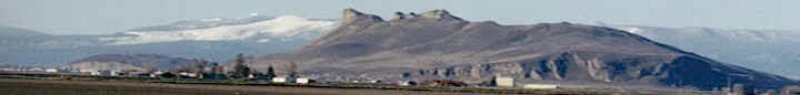
Scott River: A recent regional fisheries column has
once again dragged out the old myths about the impact of
agricultural irrigation on the
Scott
River. Here are the facts.
http://users.sisqtel.net/armstrng/facts_about_the_scott_river.htm
As a tributary, the Scott River
provides only about 4% of the full natural annual flow to
the Klamath River. According to the Siskiyou Co. Annual Crop
Report, the
Scott
Valley experiences 22
inches of annual precipitation, (30 inches of snowfall.)
This can vary widely with the east side averaging 12-15
inches and the southern mountains receiving as much as 60-80
inches. The Scott River has no dams or reservoirs.
Historically, there was storage of cool water in 28 high
mountain lakes located on the
Klamath
National Forest. As many of
these are now located in Wilderness, they have fallen into
disrepair as functional storage structures. With 292 acres
of surface, one foot of additional water storage in these
lakes could provide 5 cfs of instream flow for a 30 day
period in the summer. Storage for summer flows in the Scott
is primarily in the form of natural snowpack. Snow can hold
the water into late spring when it melts to feed the
streams.
Summer and fall flows in
the Scott vary from year to year, but are largely controlled
by the precipitation and snowpack of the prior 12 months.
(Drake, Tate and Carlson) From 1951-1998, there has been a
decrease in the water content of the snowpack in the area,
particularly in the western mountains. There has been a
correlating decline in
fall river flows over time.
The number of
irrigated acres in Scott valley has not changed
substantially since 1950. (It was 34,100 acres in 1988 and
31,800 in 2000. The total watershed is 520,968 acres, so
irrigated agriculture represents only 6% of the land.)
Methods of irrigation, (flood, wheel lines, pivot wheels,)
have changed over the years. In 1968, when water was more
commonly diverted for flood irrigation, 86% of irrigation
was through diversion of surface water, 2% groundwater and
12% mixed. In 2000, 48% was surface water, 45% groundwater
and 7% mixed.
Understanding the affects of irrigation on
flows is complex. Flood irrigation diverts water directly
from the stream, Other methods rely on water pumped from the
wells. Summer in Scott Valley can see ambient air temperatures in
the 90-100 degree F. Different methods of irrigation can
affect the amount of water consumed through evaporation,
plant transpiration and how much is returned to the soil to
feed subsurface flow and to recharge the aquifer. For
instance, pivot wheels are thought by the state of CA to be
the most efficient method of delivering irrigation water.
They can have a high evaporation rate, while less efficient
flood irrigation returns water not directly consumed in
evapotranspiration to the streams as tailwater. Groundwater
use, although not taking water directly from the stream, can
intercept subsurface flows.
Photos are often cited as documentation
that irrigators are “sucking the river dry.” In many areas
of the valley, heavy gravel sedimentation has raised the bed
of the tributaries above that of the mainstem Scott. In some
areas, historic mining has caused build up of gravels. In
Kidder Creek, an historic fire upstream cause mass erosion
resulting in gravel deposits. In such cases, water passing
through seeks its own level. The river will flow through the
gravels where it has accumulated and resurfaces on the other
side.
In many areas of the
State “conjunctive use” is the method of water storage. This
is where water is injected or percolated down into the
ground in concentration in order to recharge the aquifer as
a storage receptacle. According to a presentation by Dr.
Thomas Harter, the average annual discharge in the Scott Valley watershed is 615,000 acre feet of
water. This is more than the groundwater basin can hold
(400,000 acre ft. capacity– U.S. Geological Survey.) Of
this, the Department of Water Resources has estimated that
agriculture uses only 70-90,000 acre ft. annually. In
general, any groundwater loss is recharged within a year. It
is reasonable to expect better system responses with a more
sophisticated understanding of the groundwater in Scott Valley, renewed use of the historic
mountain lakes, and downstream movement of some of the
gravel build-up.
Scott Valley farmers and ranchers have been
working on salmon “restoration” and conservation projects
for decades. The Northern California Coastal Coho Salmon is
listed both on the federal and the State level as a
“threatened species.” Preliminary Dept. of Fish and Game
Spawning Run Estimates for coho from 2006/07 - 2009/10
illustrate that run counts in Scott Valley are, by far, among the highest in
the State. Our farmers and ranchers are obviously doing
something right.